A Florida Panhandle Map is crucial for various purposes, providing valuable information for residents, travelers, and planners.
Related Post –
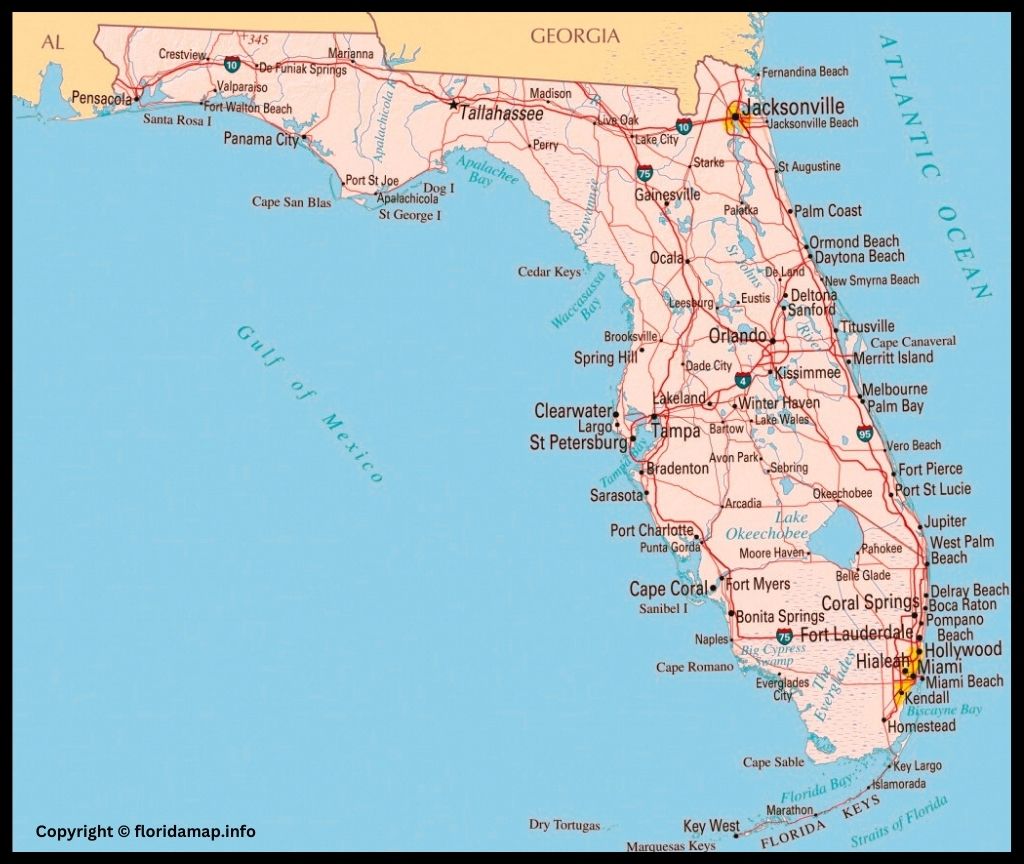
Florida Panhandle Map
Here are some key aspects of its importance and use:
Geographical Navigation: The Florida Panhandle map aids in navigating the region’s cities, towns, highways, and natural features. Whether someone is driving through the area, planning a road trip, or exploring local attractions, a map is an essential tool for understanding the lay of the land.
Tourism and Recreation: For tourists and outdoor enthusiasts, the Panhandle Florida Map is invaluable for locating popular destinations, beaches, state parks, and recreational areas. It helps visitors plan their itineraries, ensuring they don’t miss out on attractions like Destin’s beaches, Apalachicola’s historic charm, or Pensacola’s cultural sites.
Emergency Preparedness: In a region prone to hurricanes and tropical storms, having an accurate map is crucial for emergency preparedness. Residents can use it to identify evacuation routes, locate emergency shelters, and understand flood zones. Emergency management officials also use detailed maps to plan and respond to natural disasters.
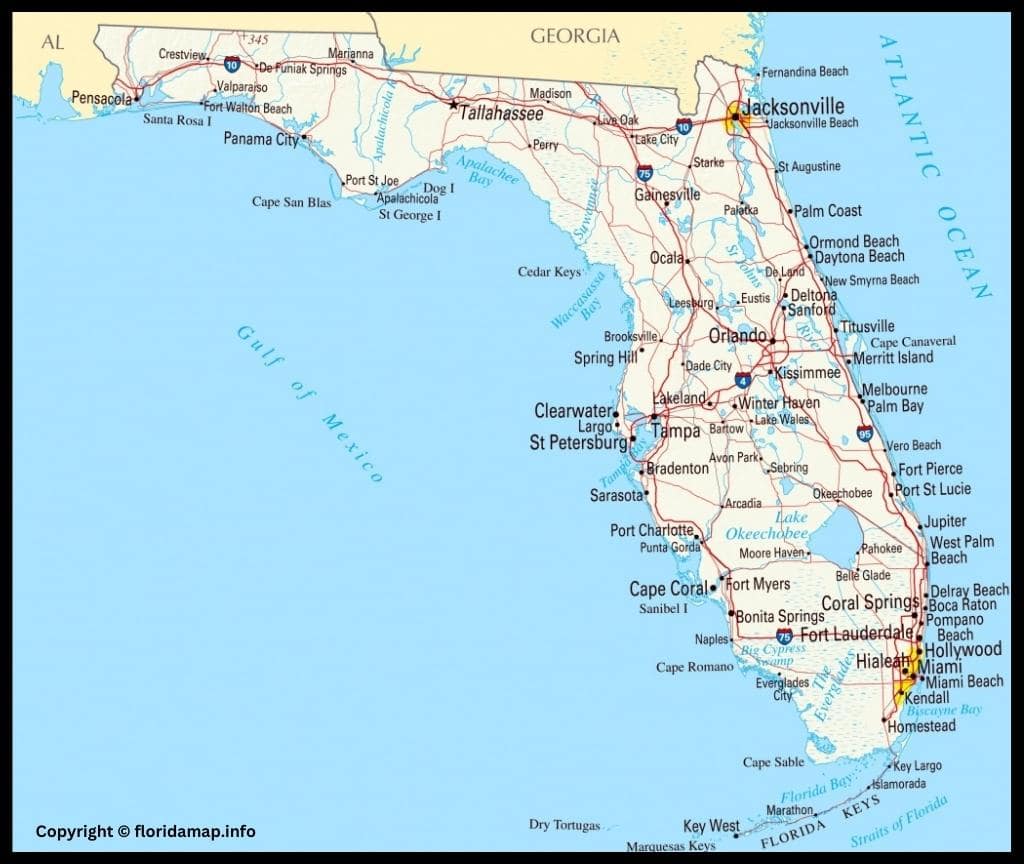
Florida Panhandle City Map
Real Estate and Development: For real estate professionals, developers, and city planners, the map serves as a vital tool for understanding land use, zoning regulations, and development opportunities. It helps in making informed decisions about where to build infrastructure, residential areas, and commercial spaces.
Educational and Research Purposes: Students, researchers, and educators use maps for studying the geography, demographics, and historical development of the Florida Panhandle. Maps contribute to a better understanding of the region’s cultural, economic, and environmental characteristics.
Infrastructure Planning: Engineers and infrastructure planners use maps to plan transportation networks, utilities, and other critical infrastructure. This ensures efficient connectivity and supports sustainable development in the region.
Business and Commerce: Businesses use maps for market analysis, identifying potential customer bases, and planning distribution networks. Understanding the geographic layout of the Florida Panhandle is essential for making informed business decisions.
Environmental Conservation: Environmentalists and conservationists use maps to identify and protect natural habitats, wetlands, and endangered species. This information is crucial for sustainable development and conservation efforts in the area.
Florida Panhandle map is a versatile tool that plays a significant role in enhancing navigation, safety, development, research, and various aspects of daily life in the region.
Map of Florida Panhandle Beaches